This weekend I went back to the old Polish Catholic immigrant neighborhood near the confluence of highways 131 and 196 on the West Side of Grand Rapids. Instead of images from the ground, I photographed St Mary Church and the Basilica of St. Adalbert with my DJI drone. I also got images of the old Widdicomb Furniture factory and the confluence of 196 and 131.
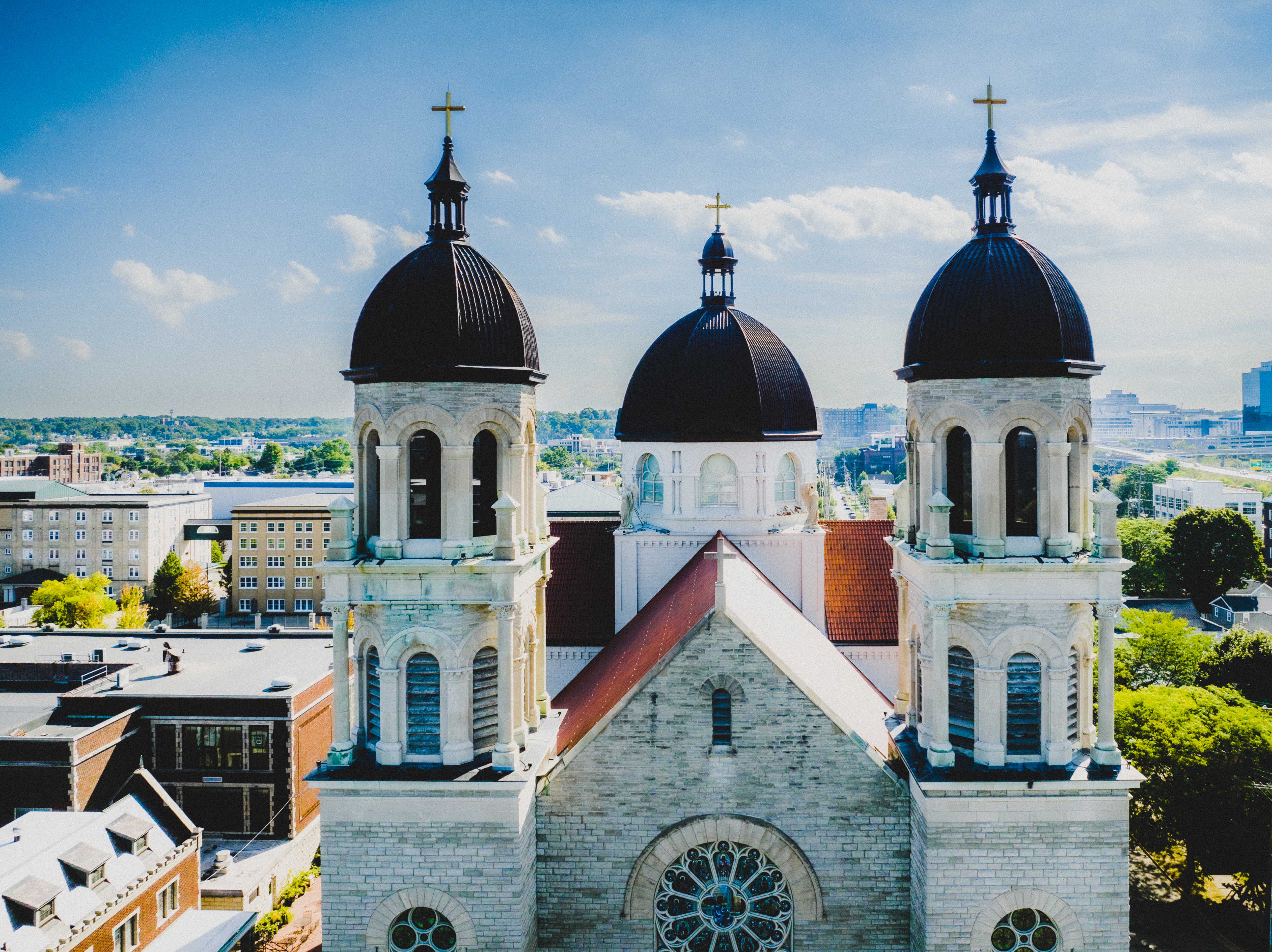
The first couple of images are of the basilica. I processed the first one to look bright and airy and accentuate the oxidized, now black copper of the domes. You can catch glimpses of the larger neighborhood and the buildings of downtown GR on the right. The second image shows off the context more fully. The buildings in the neighborhood would be recognizable to people from 75 or more years ago, but the downtown business district is much more transformed.

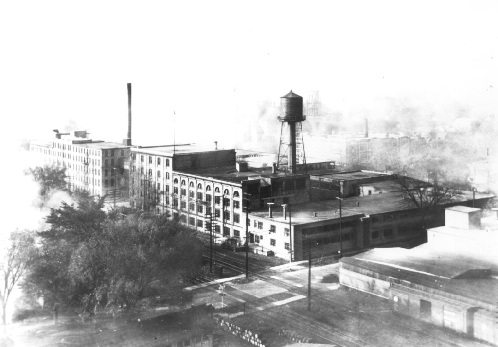
Nearby the basilica is the Widdicomb Furniture factory. This was a blue-collar immigrant neighborhood. I image that the people who worshipped at the basilica and St. Mary Church walked from their homes to both worship at the churches and work at factories like Widdicomb’s. Not just Polish Catholic immigrants, but Dutch Reformed immigrants too.
The first image shows the building today. I gave it a 1970s-ish postcard look. The second is a historic one of the factory and neighborhood at they looked around 1930. (Courtesy of Heritage Hall, at Calvin University.) A lot has changed. the water tower of the factory is gone. The factory likely has been converted multiple times, offering office space now. The streets have changed. But you can still see the Basilica of St. Adalbert peeking behind the factory building in both images (behind the water tower in the old image).

Finally, St. Mary Church, also Roman Catholic. It’s not as grand as the basilica, but it’s a lovely building, nonetheless. The third image shows off urban progress, with a major highway (131) just a few meters from the church.


Finally, the highway itself, and downtown Grand Rapids on the east side of the Grand River. It gave this image, once again, a 1970s postcard feel, conveying something of the era when such highways were built, displacing thousands of people from homes, along with schools, businesses, and churches, cutting neighborhoods off from each other, often breaking up African American communities and exacerbating segregation (e.g., in Detroit and NYC). Some of the large buildings you see on the left on the east side of the river once were factories or warehouses and now are condos.

As the image suggests, there is from the sky a kind of elegance to these highways. And you can see why they once felt like urban progress, promising to whisk people from home to work in the city and back. Today we are much more aware of the social, economic, and environmental entropy they also created. Along with traffic jams of a new sort. At morning and afternoon rush hour, a “crawl” more than a “whisk.”
